Built Environment
|
|
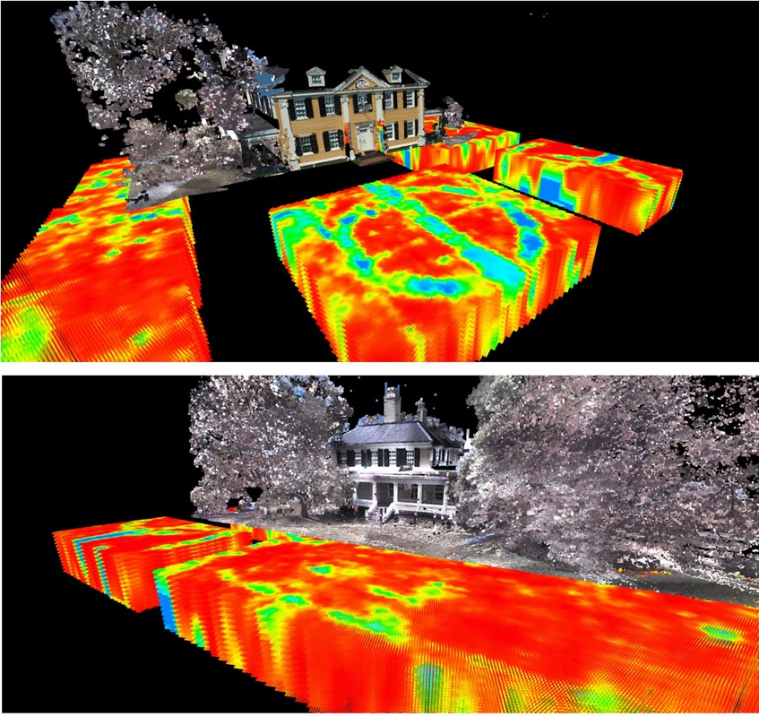
VES works as project manager and facilitator for integrated historical and urban infrastructure landscape projects. Urban sub-surface and existing environment mapping contribute significantly to not only an increased comprehension of the above and below ground environment, it also provides highly accurate maps and plans for building construction, refurbishment or demolition management.
|
· Project planning – sub-surface mapping, 3D laser scanning
· RFP development and proposal review
· Geophysical surveys for sub-surface feature mapping
· GPR training for concrete assessment and utility mapping, RADAN (6 and 7)
· RFP development and proposal review
· Geophysical surveys for sub-surface feature mapping
· GPR training for concrete assessment and utility mapping, RADAN (6 and 7)
Urban Infrastructure Mapping
|
Historical structure and environment visualization provides an innovative base for project and long term property and heritage management.
|
|